LUBBOCK, Texas — KAMC Meteorologist Jacob Riley has your Saturday evening weather forecast. Sponsored by J Ferg Pros.
Now that it is September, many have been hoping that it will finally begin to feel a little like Fall. Over the past several weeks, we have remained above average with our temperatures. Fortunately, it looks like this trend will come to an end, at least temporarily, this upcoming week.
Over the past week, high pressure has continued to dominate our region. This has prevented any rain over the region for the last 7 days! In fact, here in Lubbock, it has been 10 days since we have had measurable rainfall. That will change as soon as tomorrow night. As of right now, no severe storms are anticipated with this system.
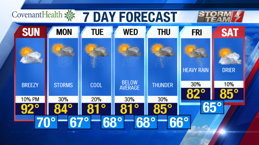
A trough will move into our area from the north and west Sunday night. Before it does, we will have one more day with high temperatures in the lower 90s across the South Plains. We will see cloud coverage increase during the evening hours on Sunday, with breezy winds out of the south around 12 to 18 MPH. After 6 PM, we will begin to see showers and storms increase across extreme northwestern portions of the area. Showers will increase overnight, as lows drop down into the upper 60s and lower 70s.
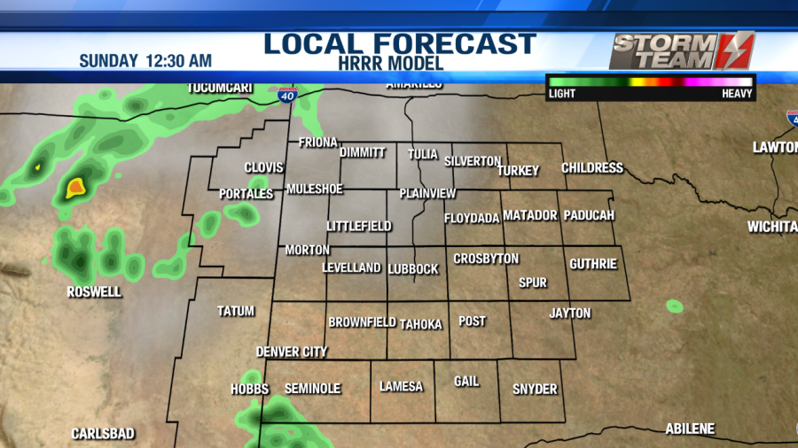
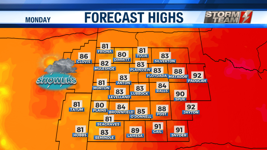
By Monday, showers and storms will become more widespread across the region. Rainfall amounts will vary from 0.25″ to 0.75″. High temperatures will actually be around 5 degrees below average, only reaching the middle and lower 80s. Winds will continue to be breezy on Monday, gusting as high as 30 MPH at times. Overnight lows will remain mild, dropping into the middle and upper 60s.
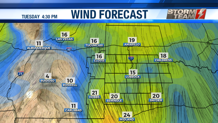
Tuesday and Wednesday will be the coolest days of the week. High temperatures will only top out in the upper 70s and lower 80s. Winds will remain breezy, gusting upwards of 30 MPH at times. Our nearly stationary trough will continue to provide widespread shower and storm chances across the region. Rain totals will vary from 0.25″ to 2.00″ on both days. Overnight lows will remain in the middle and upper 60s.
Thursday will be a little warmer, with highs in the middle 80s. Showers and storms will be possible for the area once again, with rain totals ranging from 0.50″ to 1.50″ across the South Plains and eastern plains of New Mexico. Winds will remain breezy, under a partly cloudy sky. Overnight lows will drop down into the middle 60s.
By Friday, showers and storms will continue across the area, but they will not be as widespread. High temperatures will only top out in the lower 80s, with rainfall totals varying from 0.25″ to 0.75″. Winds will not be as strong on Friday, topping out around 15 MPH out of the southeast. Overnight lows will be a little cooler, bottoming out in the lower to middle 60s.
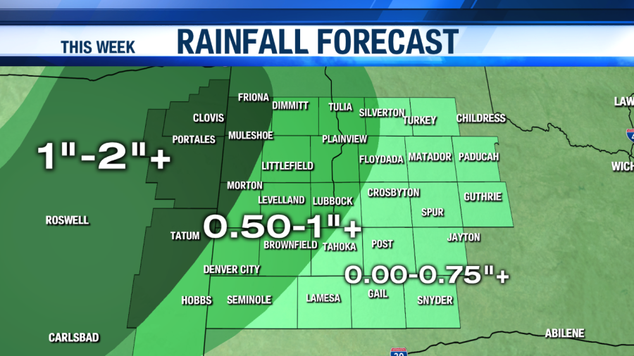
By the end of the week, rainfall totals will range anywhere from 1 to 3 inches across the region. Some areas could see locally higher amounts. This will be SO beneficial to our ongoing drought conditions.
We will dry out just a tad by Saturday, with daytime highs in the middle 80s under a partly cloudy sky. Overnight lows will drop down into the lower 60s.
Have a great evening!
-Jacob
Facebook: Meteorologist Jacob Riley
Twitter: @jrileywx


