LUBBOCK, Texas — KAMC Meteorologist Jacob Riley has your Saturday evening forecast. Sponsored by J Ferg Pros.
Overnight, temperatures will still be chilly as lows drop into the middle and lower 30s by sunrise on Monday. Winds will remain out of the southwest around 8-12 MPH throughout the overnight hours. Areas to the south of Lubbock will see a few clouds move into the area.
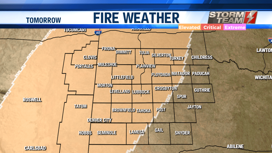
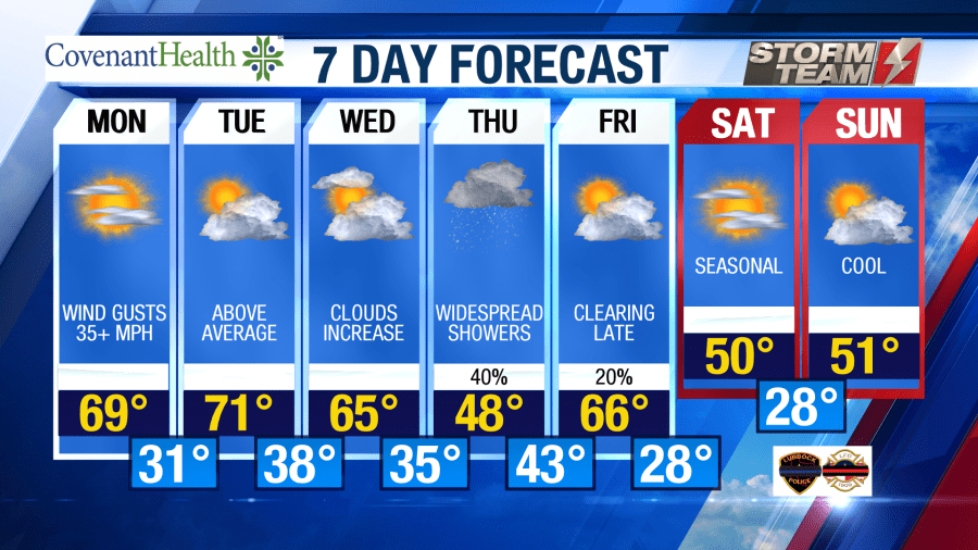
Monday through Wednesday will be well above average in terms of temperatures. High temperatures will range from the middle 60s to middle 70s each day. On Monday, we will have a mostly sunny sky across the area. Winds will increase out of the southwest, gusting close to 40 MPH at times. This, combined with low relative humidity values, will result in an increased risk of fire danger for portions of the South Plains. Outdoor burning is discouraged tomorrow. Overnight lows for Monday will fall into the upper 20s and lower 30s.
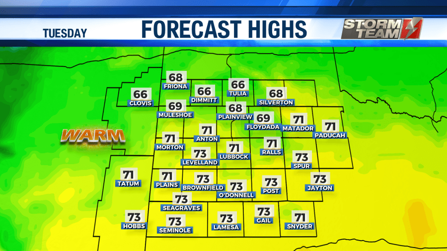
Tuesday will be the warmest day out of the next 7. Highs will be nearly 20 degrees above average across the South Plains. Cloud coverage will begin to increase across the region, leaving us with a partly cloudy sky. Tuesday night will be mild, with lows in the upper 30s.
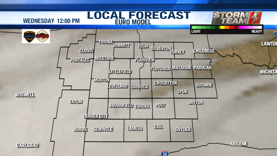
By Wednesday, we will be locked in under a mostly sunny sky across the South Plains. An increase in mid-level moisture will allow for clouds to increase ahead of our next weather-maker. By Wednesday night, a cold front will move into the area. Lows will drop into the middle 30s by Thursday morning.
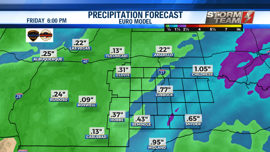
Highs on Thursday will be in the upper 40s and lower 50s. Heavy rainfall will arrive later in the day. The best chance of rain will be from Thursday evening through Friday morning. A warm front will move from south to north through the area, resulting in a nice steady rain.
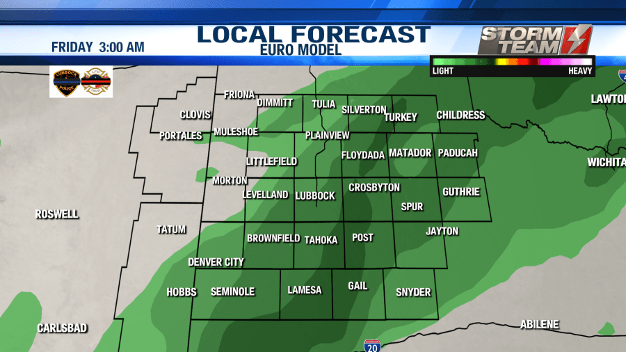
Behind the warm front on Friday, highs will warm into the middle 60s! Friday night, a cold front will sweep through the region, pushing the rain to our east. Rainfall totals will be around 0.50″ in the Lubbock metro area. Totals could be a bit higher to our east. Lows will fall into the upper 20s and lower 30s Friday night.
We will transition into more of a cooler pattern next weekend. Highs on both Saturday and Sunday will struggle to make it into the lower 50s.
Have a great week!
-Jacob
Facebook: Meteorologist Jacob Riley
Twitter: @jrileywx
This post was updated at 10:38 PM to add the forecast video.


