
LUBBOCK, Texas — KAMC Meteorologist Ron Roberts has your Monday evening forecast. Sponsored by J Ferg Pros.
Tonight: Severe storms early, low of 55°. Winds from the SSE 10-20 MPH.
Tomorrow: Evening severe storms, high of 81°. Winds out of the SSE, 15-25 MPH.
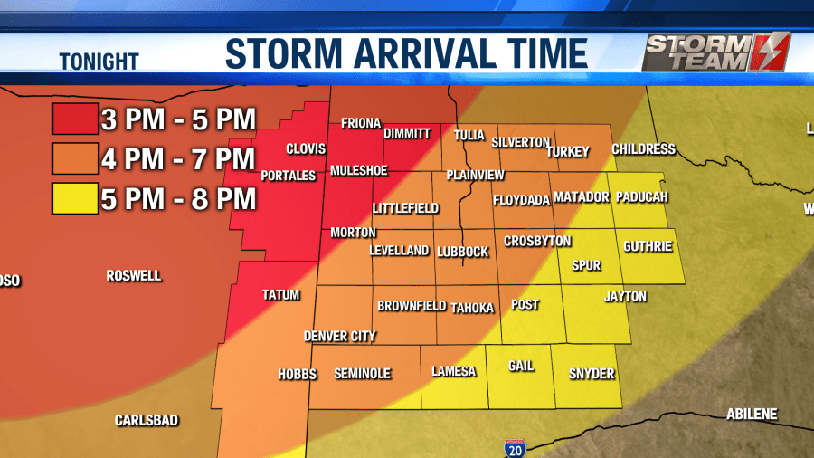
Severe weather is expected during the evening and early overnight hours tonight. A level 2 slight risk for severe storms has been issued for nearly all of the South Plains area. Damaging winds up to 70 MPH, 2.00″ hail (lime-sized) and a few tornadoes are all possible.


Storms will begin to develop around 4 PM near the Texas and New Mexico state line. Below is a timeline of when you can expect severe storms to arrive in your area.
As we head into the overnight hours, showers and storms will begin to exit the region. Rain showers will remain likely overnight, but our severe threat will come to an end. Lows will fall into the middle 50s. Rainfall totals could top 1 inch in some areas. Winds will remain out of southeast around 10-20 MPH.
On Tuesday, we will see another round of severe storms as we head into the afternoon and evening hours. High temperatures will warm into the upper 70s and lower 80s under a partly to mostly cloudy sky. A level 1 marginal risk for severe storms is in effect for eastern portions of the South Plains. This does not include Lubbock as of now.
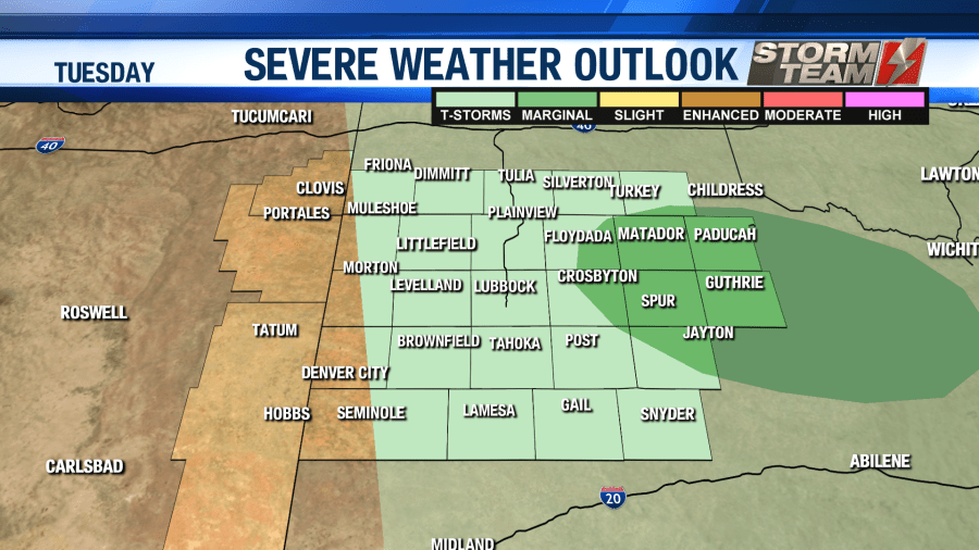
This will give us enough instability to see a few storms produce damaging wind gusts and large hail. Winds will be out of the southeast around 15-20 MPH. Timing for tomorrow’s storms will be during the afternoon and early overnight hours. As we head past midnight, a few isolated showers will remain possible to the east of Lubbock. Lows will fall into the upper 50s and lower 60s.
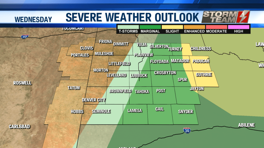
Round three of severe storms will arrive on Wednesday. Eastern portions of the South Plains have been put under a level 2 slight risk for damaging winds, large hail and isolated tornadoes. Lubbock is included in a level 1 marginal risk.
High temperatures will top out in the upper 80s and lower 90s, with breezy winds out of the southwest. Winds could gust as high as 40 MPH outside of thunderstorms. Overnight, we will remain dry with breezy southwesterly winds remaining across the region. Lows will fall into the upper 50s and lower 60s.
On Thursday, highs will remain well above average, topping out in the lower to middle 90s under a mostly sunny sky. Fire weather will be a possibility with gusty winds and low relative humidity values. Outdoor burning will not be advised. Winds will gust close to 35 MPH out of the southwest. Overnight, temperatures will fall into the middle and lower 60s.
As we head into the weekend, we will gradually begin to dry out with only isolated afternoon shower and storm chances across the area. Highs will be in the 90s on Friday, and fall back into the 80s for Saturday.
We will slowly warm back up Sunday into Monday, with 90s returning to the region. An extended outlook shows the 90s sticking around for most of next week.
Stay weather aware, friends!
-Ron.
Facebook: Ron Roberts KAMC
Twitter: RonRoberts.TV


