LUBBOCK, Texas — The first significant threat of severe weather this season is expected across the South Plains and the Rolling Plains on Tuesday.
The primary window for severe weather will be from late Tuesday afternoon and into evening hours. Storms could linger into the overnight period.
The Storm Prediction Center (SPC), a part of the National Weather Service, forecasts severe thunderstorm and tornado outlooks.
The SPC has placed a “moderate” risk for severe weather across the northeastern South Plains and the northern Rolling Plains.
There is an “enhanced” risk for portions of the South Plains, including the Lubbock metro area, and the rest of the Rolling Plains.
There is a “slight” and “marginal” risk across the western South Plains.
Below is an explanation of severe weather risks and the threats associated with each category.

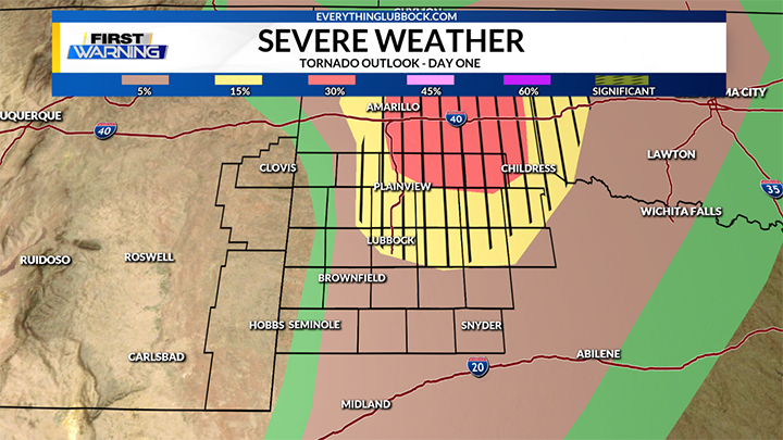
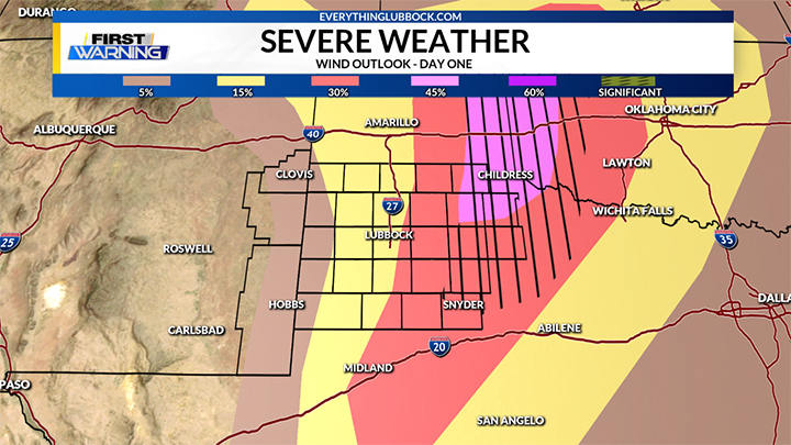
Large hail and damaging wind are the primary severe weather concerns, although a few tornadoes will be possible.
There is also a risk for flash flooding with the storms.
Below is a breakdown of the threat for tornadoes, hail and damaging wind.

Related Content:
- Current Weather Alerts from EverythingLubbock.com
- EverythingLubbock.com Interactive Radar
- KAMC Storm Team Weather Lab
- KLBK First Warning Weather Center


