
LUBBOCK, Texas — KAMC Meteorologist Jacob Riley has your Sunday evening forecast. Sponsored by J Ferg Pros.
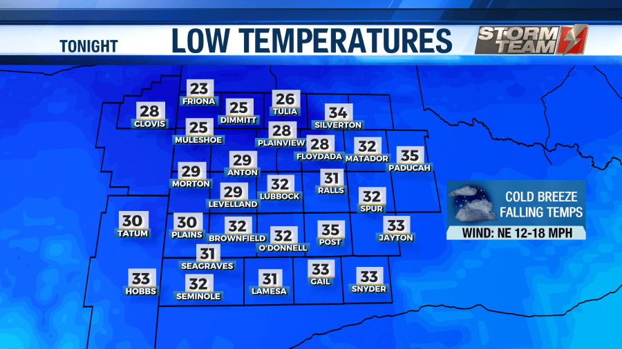
A cold front will continue to pass through the region tonight. This will allow low temperatures to fall into the lower 30s and upper 20s tonight under a mostly cloudy sky. Winds will shift to the northeast, gusting close to 25 MPH at times. A Winter Storm Watch goes into effect for areas to the northwest of Lubbock at 9 PM tonight, lasting through 6 AM Wednesday morning.
Early Monday morning, scattered showers will move into the area. With temperatures below freezing, some areas of freezing rain are expected. This will not have a major impact on area roadways.
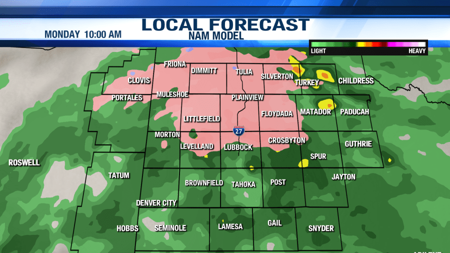
Mainly elevated surfaces such as bridges and overpasses could have a few slick spots. Temperatures will warm above freezing around noon as precipitation begins to exit the region. Highs on Monday will likely occur at midnight, peaking in the middle to lower 40s. Rain totals will remain light. Overnight lows on Monday will drop back below freezing, bottoming out in the upper 20s and lower 30s.
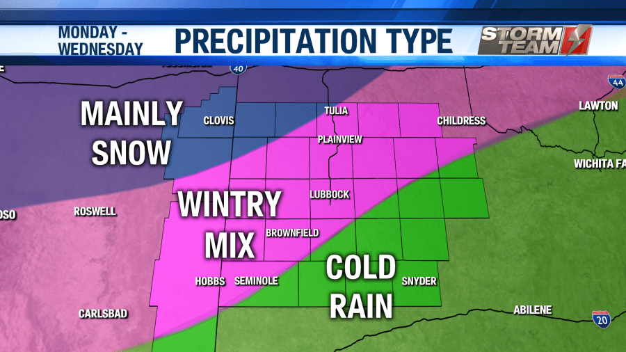
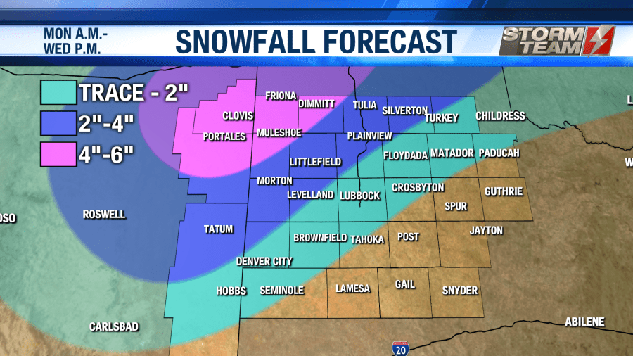
The second wave with this winter storm will arrive into the area overnight Monday into Tuesday morning. Areas from Tatum, NM to Morton, Littlefield and Tulia will likely remain in the form of Snow throughout the entirety of the event.
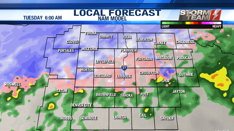
The second wave with this winter storm will arrive into the area overnight Monday into Tuesday morning. Areas from Tatum, NM to Morton, Littlefield and Tulia will likely remain in the form of Snow throughout the entirety of the event.
From these areas to the southeast will start off as a wintry mix. Warmer air higher up in the atmosphere will melt any snowflakes, resulting in freezing rain and sleet across the middle portions of the area.
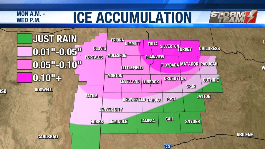
Freezing rain will be the main concern with this system. Up to 0.10″ of ice is expected in Lubbock, which will sag power lines and make roadways very slick.
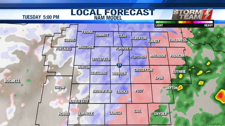
By 3 PM, the upper levels of the atmosphere should drop below freezing, resulting in mostly snow across the northeastern two-thirds of the area. High temperatures will remain right around freezing on Tuesday, meaning that ice and snow will linger throughout the entire day.
The Lubbock metro area will have a brief period of about 2-4 hours of snowfall. We could see anywhere from 0″-2″ of snow in the metro area, with the highest totals remaining over northwestern portions of the area.
Precipitation will begin to wrap up late Tuesday night into Wednesday morning. Overnight lows will fall into the upper 10s and lower 20s. Areas that see heavy snowfall will likely fall into the lower 10s.
Wednesday morning will be cold any icy across the region. Travel impacts will continue to be felt across the region, especially to the northwest of a line from Seminole to Childress. High temperatures will remain in the middle to lower 30s for areas that saw accumulating ice and snow. Areas who remained mostly rain will top out in the lower to middle 40s under a partly cloudy sky. Overnight lows will be quite chilly, falling back into the middle and lower 20s.
Thursday will be another below average day with highs in the middle 40s under a partly cloudy sky. Overnight lows will fall back close to average, dropping into the middle and upper 20s.
As we head into the weekend, conditions will improve across the region. Highs will return to the upper 50s and lower 60s. By Sunday, a few sprinkles may return to the region, but most of us will remain dry.
Have a safe and warm week!
-Jacob
Facebook: Meteorologist Jacob Riley
Twitter: @jrileywx


