
LUBBOCK, Texas — KAMC Meteorologist Jacob Riley has your Saturday evening forecast. Sponsored by J Ferg Pros.
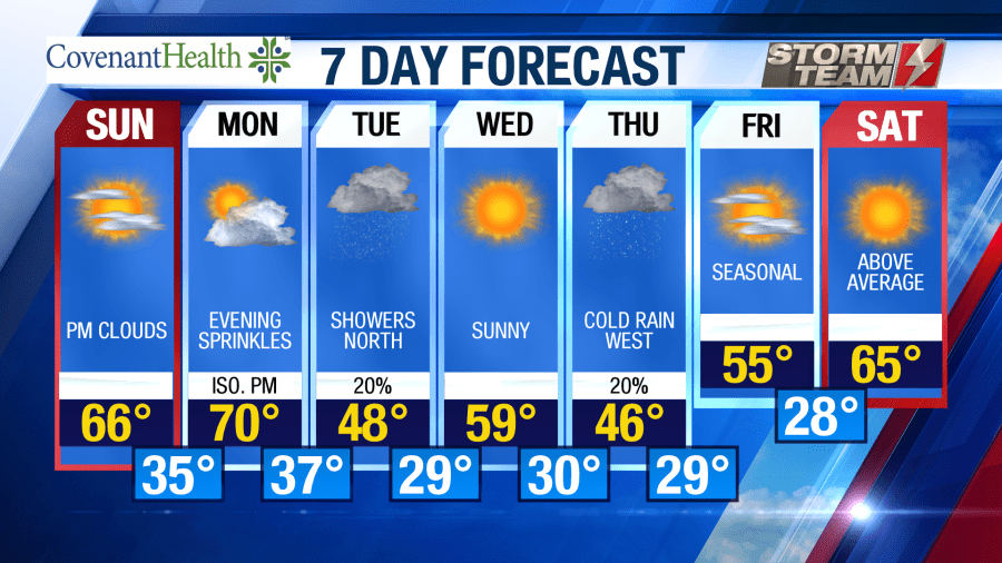
Another cold night is in store for us across the South Plains. Low temperatures will fall into the upper 20s and lower 30s by sunrise on Sunday morning. We will see our clear sky remain overnight with winds out of the northwest around 5-10 MPH.
Sunday and Monday will be well above average in terms of temperatures. Average highs this time of year are in the middle 50s. On both Sunday and Monday, we will warm into the upper 60s and lower 70s. Winds will be out of the southwest around 8-12 MPH each day. Clouds will increase during the evening hours on Monday. A low pressure system will track through the region Monday night, bringing showers to the northern half of the area. Temperatures are expected to remain above freezing while precipitation is occurring.
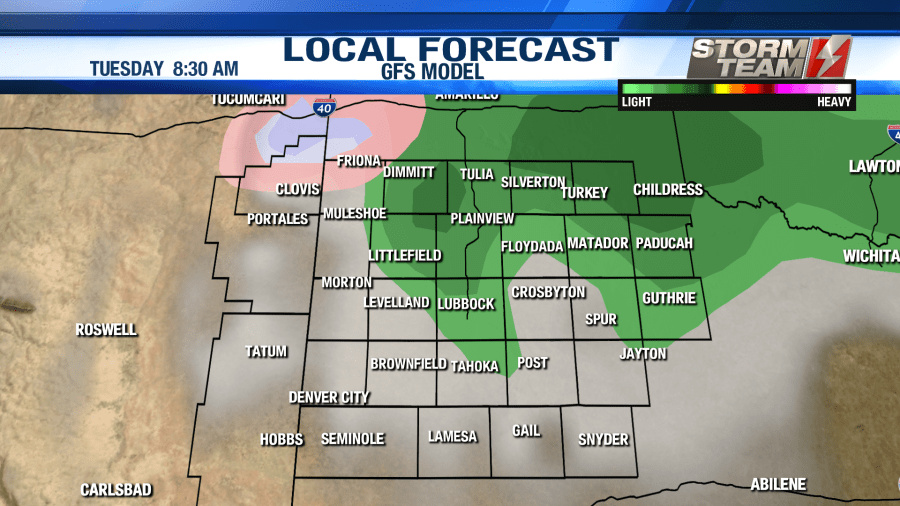
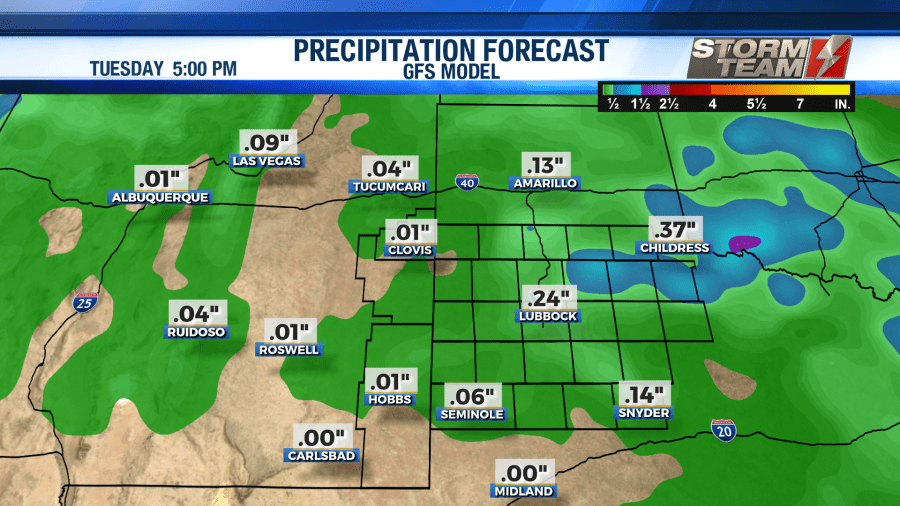
Showers will continue through the afternoon hours on Tuesday. Winds will shift to the north, gusting close to 30 MPH at times. With high temperatures only warming into the middle 40s, wind chill values will likely remain in the upper 30s most of the day. Rainfall totals will generally remain below 0.25″. Overnight lows will fall below freezing as we head into Wednesday morning, bottoming out in the upper 20s and lower 30s.
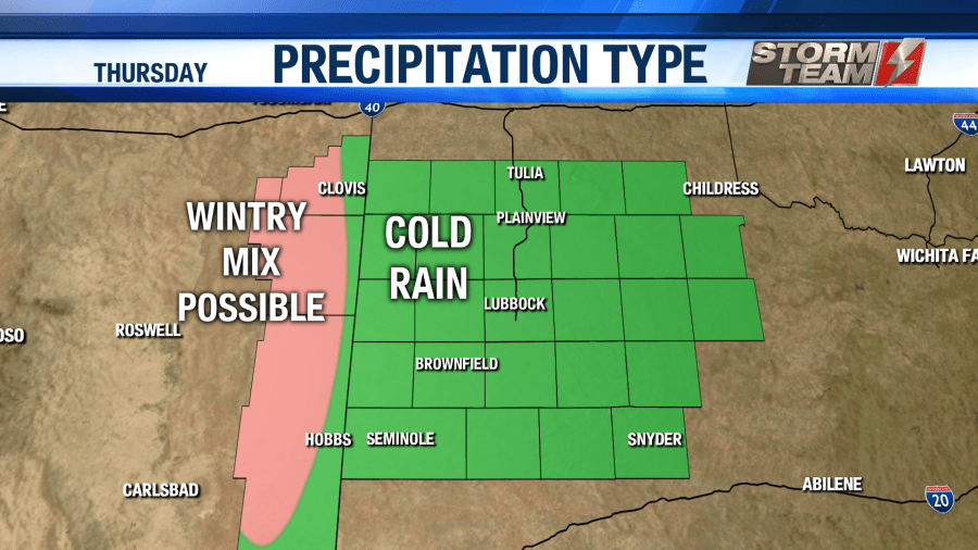
Wednesday will be a mild and sunny day, with high temperatures rebounding into the upper 50s and lower 60s, which is slightly above average. This warmth will not last for long. As we head into the overnight hours Wednesday, our next storm system will enter the region. As precipitation begins early Thursday morning, we could see a brief window of wintry precipitation over the northwestern half of the area. As of now, no major accumulations are expected.
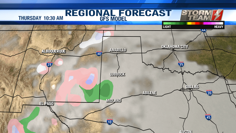
However, we could see a few slick spots on area roadways Thursday morning. Be sure to factor in some extra time for your morning commute. Please drive courteously. Temperatures will warm well above the freezing mark by the afternoon hours, topping out in the middle 40s. As precipitation comes to an end Thursday evening, lows will fall back below freezing. This could result in a few slick spots on through Friday morning. Liquid precipitation amounts will generally remain under 0.25″.
Temperatures will be on the climb for Friday and Saturday! Friday will be a fairly seasonal day, with highs in the middle 50s. Saturday will be much warmer with high temperatures in the middle to upper 60s. Overnight lows will range from the middle 20s to middle 30s both nights.
Have a great Sunday!
-Jacob
Facebook: Meteorologist Jacob Riley
Twitter: @jrileywx
This post was updated at 6:32 PM to add the forecast video.


