
LUBBOCK, Texas — KAMC Meteorologist Jacob Riley has your Wednesday evening forecast. Sponsored by J Ferg Pros.
Tonight: Mostly clear, low of 69°. Winds from the SSW 10-20 MPH.
Tomorrow: Afternoon storms, high of 97°. Winds out of the SSE, 15-25 MPH.
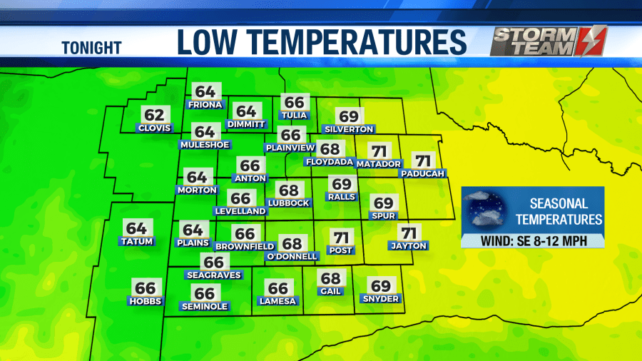
As we head into your evening and overnight hours tonight, any remaining showers or storms will being to fall apart. Winds will be out of the southwest around 8-12 MPH under a mostly clear sky. As we head into the early morning hours on your Thursday, temperatures will bottom out in the upper 60s and lower 70s.
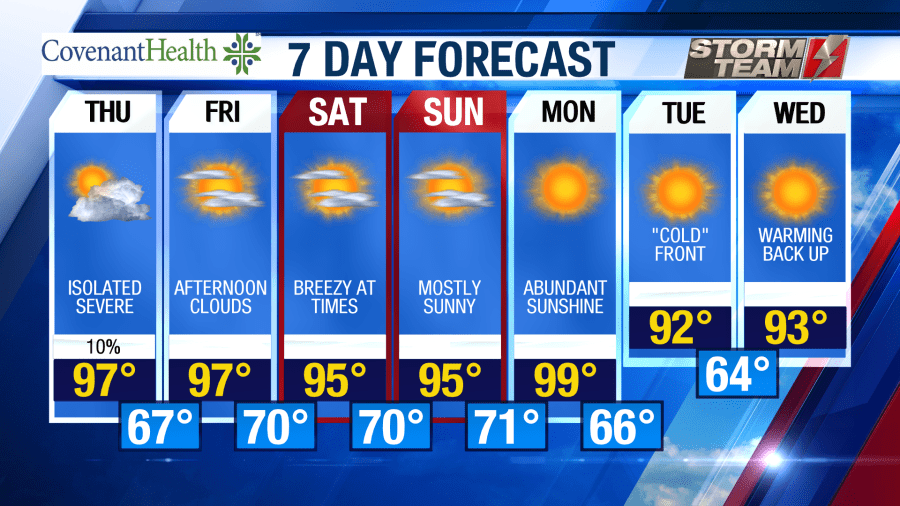
We have the potential to see a few strong to severe storms on our Thursday afternoon. Showers and storms will begin to develop during the peak daytime heating, between 3-5 PM. High temperatures will warm into the middle and upper 90s under a mostly sunny sky. Cloud coverage will increase once storms begin to develop. Winds will remain out of the southeast around 15-20 MPH. The main threat with tomorrow’s storms will be wind gusts close to 60 MPH and quarter sized hail. Severe weather will end by midnight. Overnight lows will fall into the middle 60s to lower 70s.


Friday will be another warm day with highs in the middle 90s to lower 100s across the area. Winds will remain out of the southeast around 15-20 MPH. An isolated shower or two cannot be completely ruled out, but most locations will remain dry. Overnight lows will bottom out in the upper 60s and lower 70s.
This weekend will be very summer-like across the region. Highs will remain in the middle 90s under a mostly sunny sky on both Saturday and Sunday. Winds will remain out of the southeast around 15-20 MPH. Low temperatures will remain in the upper 60s and lower 70s.
Next week, high temperatures will be in the upper 90s and lower 100s on Monday. Monday night, a weak front will move through the area. This will drop highs into the middle and lower 90s as we head towards the middle of next week.
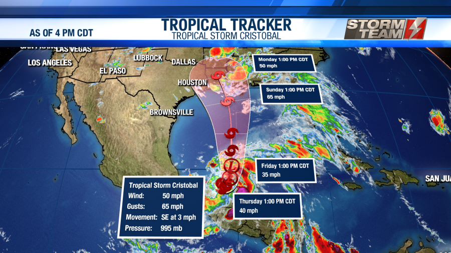
A tropical system is also expected to make landfall somewhere from Houston, TX to New Orleans, LA sometime Sunday afternoon through late Monday morning. This will bring heavy rainfall to portions of eastern Texas and Louisiana.
Have a terrific Thursday!
-Jacob.
Facebook: Meteorologist Jacob Riley
Twitter: @jrileywx


