LUBBOCK, Texas — KAMC Meteorologist Jacob Riley has your Sunday evening forecast. Sponsored by J Ferg Pros.
Throughout the overnight hours tonight, clouds will slowly increase from south to north. A low pressure system over Southern California will begin to move closer to the region, resulting in a more meridional flow aloft, simply meaning a more amplified pattern. This will also allow for colder temperatures to the north of Lubbock. Temperatures will range from the middle to lower 30s across northern portions of the South Plains. Across the northern Permian Basin, lows will only drop into the upper 40s and lower 50s.
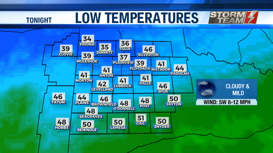
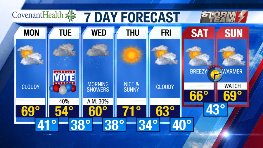
Monday will be a mild and cloudy day across the area. Highs will top out in the upper 60s and lower 70s under a mostly cloudy sky. Winds will shift from the northwest to the northeast, remaining between 8-12 MPH. As we head into the evening hours, clouds will increase as lows fall into the upper 30s and lower 40s.
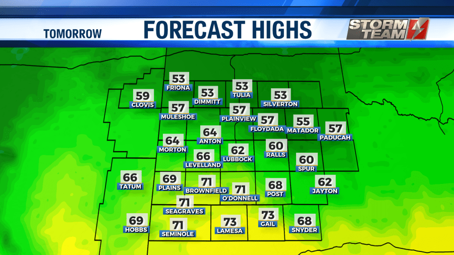
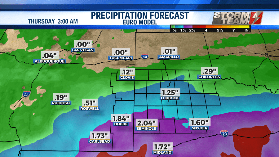
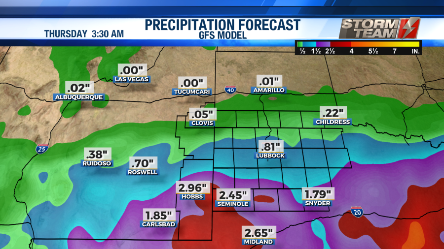
Super Tuesday will be soggy across a good chunk of the area. Rain will increase from south to north throughout the day. Models are continuing to show a better shot at some decent rainfall totals across a good portion of the South Plains. High temperatures on Tuesday will top out in the middle 50s as rain showers remain across the region. Overnight lows will dip into the middle to upper 30s.
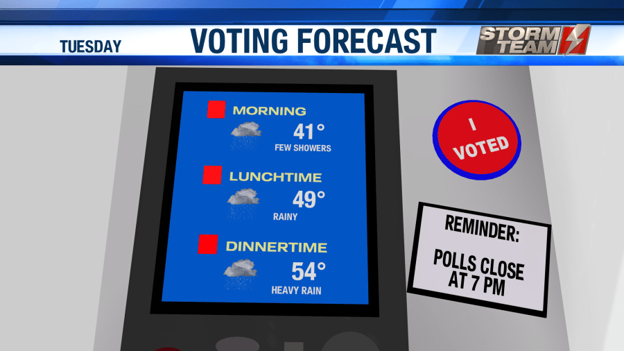
Evening clearing will be possible on Wednesday. Showers will likely linger into the early afternoon hours. Highs will top out in the upper 50s and lower 60s. In Lubbock, rainfall amounts will most likely top out between 0.25″-0.50″ by Wednesday evening. Higher totals will be possible across the Permian Basin. Overnight lows will fall into the middle and upper 30s under a clearing sky.
Thursday will be a nice and sunny day across the area! Highs will return to the lower 70s with variable winds around 10-15 MPH. Overnight lows will fall off into the lower 30s. Some patchy frost will be possible.
Clouds will increase as we head back into the weekend next week. Temperatures will peak in the middle 60s on each Friday, Saturday, and Sunday afternoon. Overnight lows will remain mild each night, only lowering into the middle 40s. Another disturbance could bring us more rainfall by next Sunday. Don’t forget to “spring forward” next Sunday as Daylight Saving Time begins!
Have a wonderful week!
-Jacob
Facebook: Meteorologist Jacob Riley
Twitter: @jrileywx
This post was updated at 10:27 PM to add the forecast video.

