LUBBOCK, Texas — KAMC Meteorologist Jacob Riley has your Sunday evening forecast. Sponsored by J Ferg Pros.
Tonight: Strong storms, low of 53°. Winds from the SE 15-25 MPH.
Tomorrow: Thunderstorms, high of 76°. Winds out of the SE, 20-30 MPH.
Showers and storms will arrive during the late evening and early overnight hours tonight. A level 1 Marginal risk for severe storms has been issued for western portions of the South Plains. Damaging winds and hail will be possible with a few storms. No widespread severe weather outbreak is anticipated.
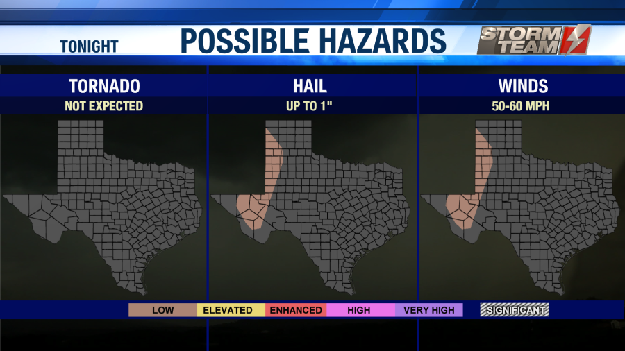

Storm activity will last into the early morning hours on Monday. Don’t be surprised if you are woken up by thunder and lightning. Rainfall amounts could approach 0.50″ for some locations. Overnight lows will fall into the middle 50s under a mostly cloudy sky. Winds will be breezy out of the southeast, gusting close to 30 MPH at times.
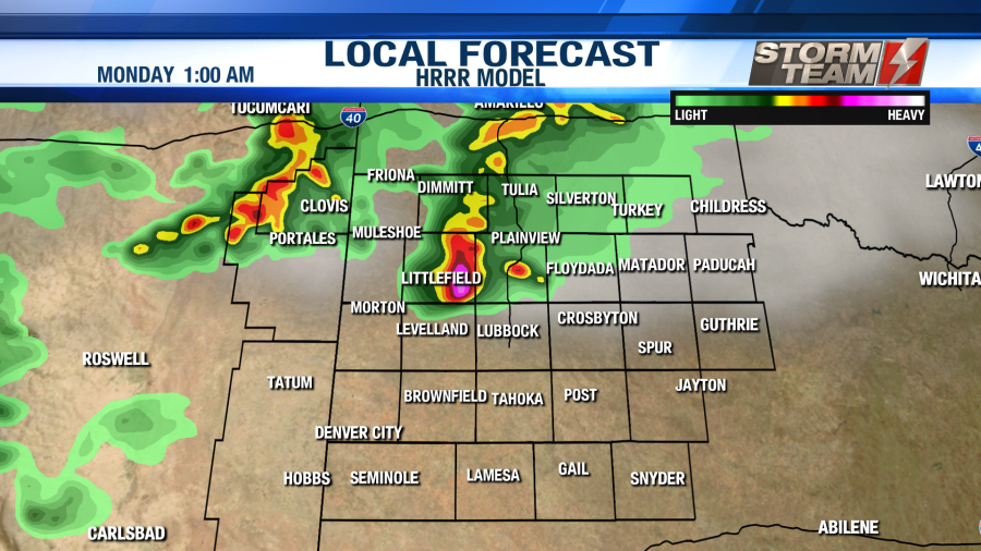
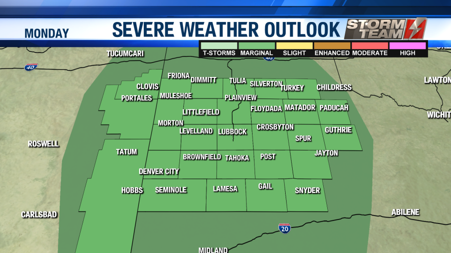
We will see a break in the storms around noon on Monday. As we head into the afternoon and evening hours, showers and storms will begin to develop along the dry line. This will result in a few strong to severe storms across the region. A level 1 Marginal risk for severe storms also exists for ALL of the South Plains on Monday. Again, the main threats will be damaging winds and hail. Isolated tornadoes are not expected, but they cannot be completely ruled out.

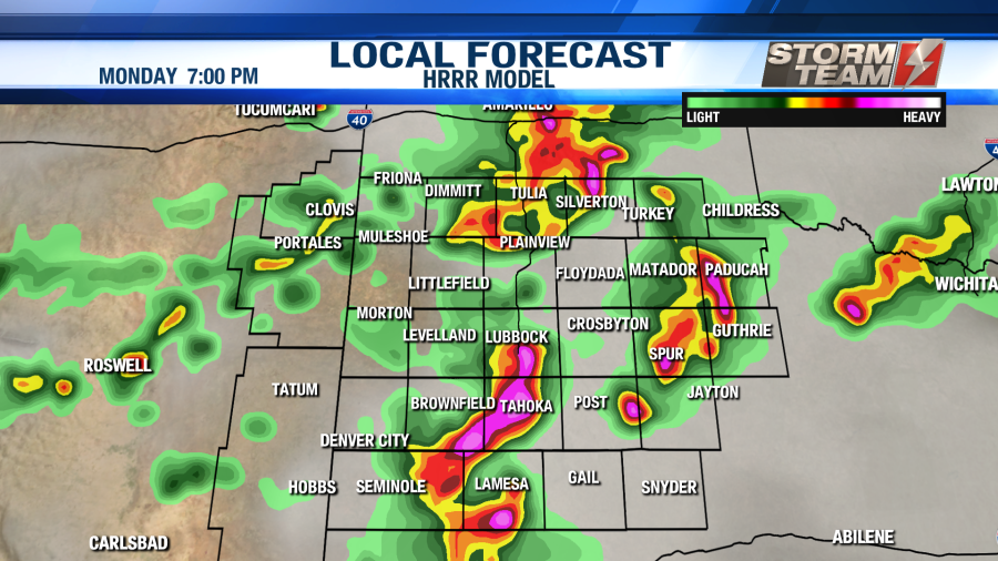
High temperatures will warm into the middle 70s under a partly to mostly cloudy sky. Winds will be out of the southeast around 18-22 MPH. Rainfall totals will range between 0.25″-0.50″ with locally higher amounts possible. Showers and storms will linger into the overnight hours, as lows fall into the middle 50s.
Showers and storms will be possible once again on Tuesday. Coverage is not expected to be as widespread on Tuesday. Highs will warm into the middle 80s under a partly to mostly cloudy sky. Winds will be out of the southwest around 10-15 MPH. No severe weather is expected at this time, but some gusty winds or small hail cannot be completely ruled out. Isolated storms will linger into the overnight hours as lows fall into the upper 50s to middle 60s.
By the time Wednesday rolls around, we will begin to warm back into the 90s! Winds will be quite strong out of the southwest, gusting close to 35 MPH at times. We could see an elevated risk for fire weather on Wednesday, so outdoor burning is not advised. Most of us will stay dry on Wednesday, but a few afternoon storms will be possible over eastern portions of the area. These storms will have the potential to be on the severe side, with large hail and damaging winds being the primary threats. Storms will push east overnight as lows fall into the middle 60s area-wide.
The 90s will stick around for Thursday and Friday. We will also keep the chance of afternoon showers and storms in the forecast for both days. Winds will be out of the southwest around 15-25 MPH each days, giving us an elevated risk for fire weather until the weekend. Overnight lows will range from the middle 50s to middle 60s each night. We will see a partly to mostly sunny sky each day.
As we head into the weekend, it looks like we will see a few afternoon showers possible over the eastern half of the area. Once this activity comes to an end, a drier and warmer pattern will move back into the area. Unfortunately, this means highs will likely return to the upper 90s and lower 100s within the next two weeks.
Have a wonderful week, and enjoy the rain!
-Jacob.
Facebook: Meteorologist Jacob Riley
Twitter: @jrileywx
This post was updated at 10:37 PM to add the forecast video.