
LUBBOCK, Texas — KAMC Meteorologist Jacob Riley has your Sunday evening forecast. Sponsored by J Ferg Pros.
Tonight: Mostly clear, low of 60°. Winds from the SE 5-15 MPH.
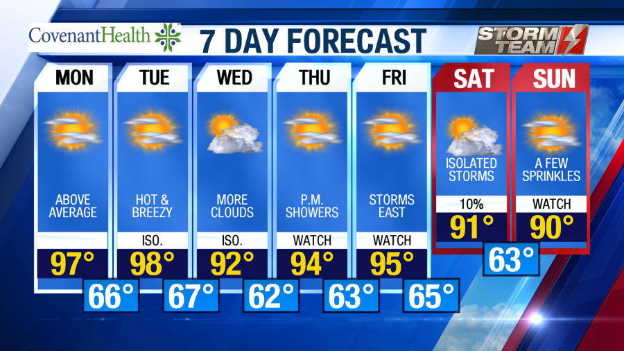
Tomorrow: Mostly sunny, high of 97°. Winds out of the S, 10-20 MPH.
Overnight tonight, most of the region will remain cloud free with winds out of the southeast around 8-12 MPH. A few showers could move into extreme northwestern portions of the south plains. This could result in a brief wind shift to the north between 2-4 AM. Lows will fall into the middle 50s to lower 60s by Monday morning.
Well above average temperatures will return to the South Plains as we start off your work week. High temperatures are forecasted to range from the middle 90s to lower 100s on Monday, under a mostly sunny sky. Winds will be out of the south around 10-15 MPH. A few afternoon showers or storms could be possible, but are not expected. If you plan on being outside, be sure to apply sunscreen! Our UV index will be at high to extreme levels, meaning you could catch a sunburn in as little as 10-15 minutes. Overnight, temperatures will remain slightly above average, only falling into the middle 60s.

Tuesday will be hot once again as highs warm into the upper 90s and lower 100s. We will see a mostly sunny sky across the area, with winds out of the south around 12-18 MPH. Isolated showers and storms could be possible once again by Tuesday afternoon. Overnight lows will remain in the middle 60s area wide.
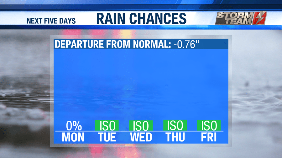
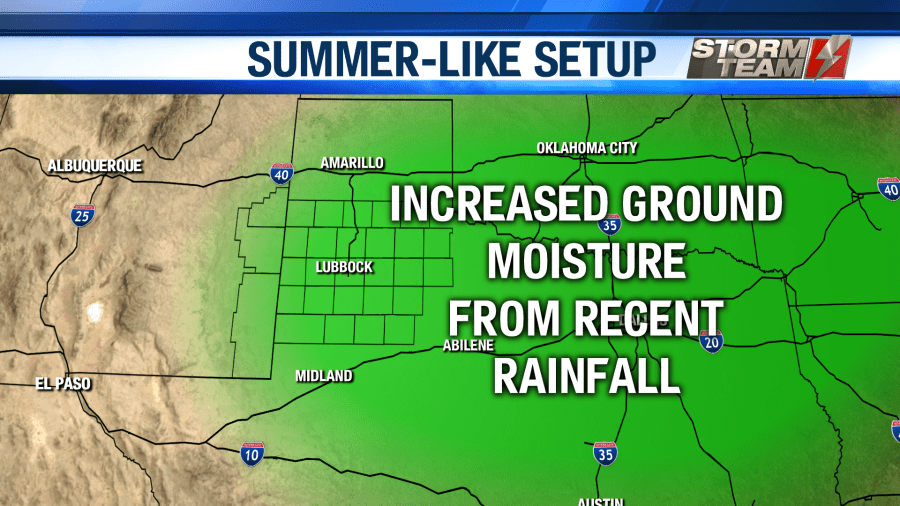
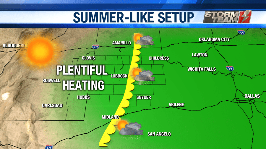
Over the next week, isolated showers and storms will remain a possibility nearly every afternoon. Due to recent rainfall, the dry-line is now able to back further to the west. This boundary will provide enough lift to bring us an isolated chance of rain over the next seven days! Not everyone is going to see rainfall. In fact, most of us will remain dry. This isn’t the news that most West Texan’s want to hear, especially since a drought is beginning to develop across the region. Just know that there could be isolated showers each afternoon over the next week or so.
On Wednesday, we will see a few more clouds move into the region. This will help to lower our high temperatures into the middle and lower 90s for Wednesday. Afternoon showers will remain a possibility. Winds will be out of the southeast around 15-20 MPH, gusting as high as 30 MPH at times. Overnight Wednesday into Thursday morning, low temperatures will drop into the upper 50s and lower 60s.
On Thursday and Friday, our forecast won’t change too much. Highs will top out in the middle 90s under a mostly sunny sky. Winds will remain out of the south-southwest around 10-20 MPH. The chance of an afternoon shower or two will hang around, and overnight lows will remain in the middle 60s.
As we head into next weekend, showers and storms could increase in coverage. No widespread rainfall is anticipated at this time, but rain chances will increase for Saturday and Sunday. Unfortunately, this also means that our drought conditions will likely expand across the South Plains. Highs will cool into the upper 80s and lower 90s under a partly to mostly sunny sky. Winds will shift back to the southeast, bringing in a bit more moisture to the area. Overnight lows will stay in the upper 50s and lower 60s.
Have a wonderful week!
-Jacob
Facebook: Meteorologist Jacob Riley
Twitter: @jrileywx
This post was updated at 10:30 PM to add the forecast video.


