LUBBOCK, Texas — KAMC Meteorologist Jacob Riley has your Sunday evening forecast. Sponsored by J Ferg Pros.
Tonight: Clear, low of 60°. Winds from the SE 10-20 MPH.
Tomorrow: Partly Cloudy, high of 83°. Winds out of the SE, 15-25 MPH.
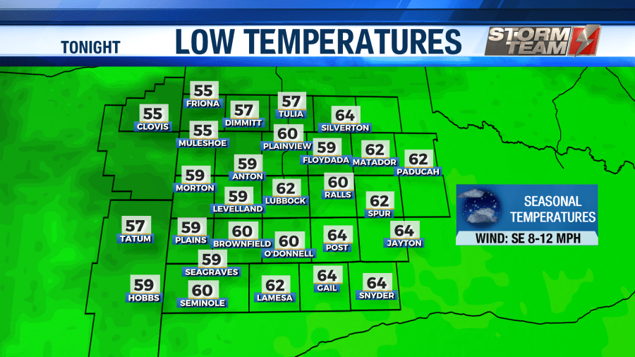
Clouds will hang around with us throughout the overnight hours tonight. This will provide a little more insulation across the region, resulting in warmer low temperatures for Monday morning. We will bottom out in the middle to lower 60s. Winds will remain out of the southeast around 8-12 MPH.
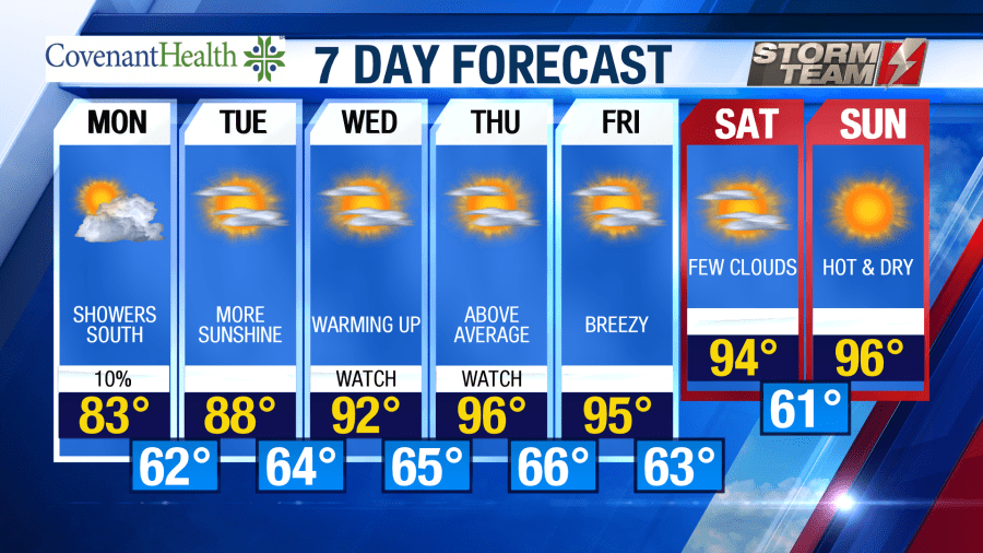
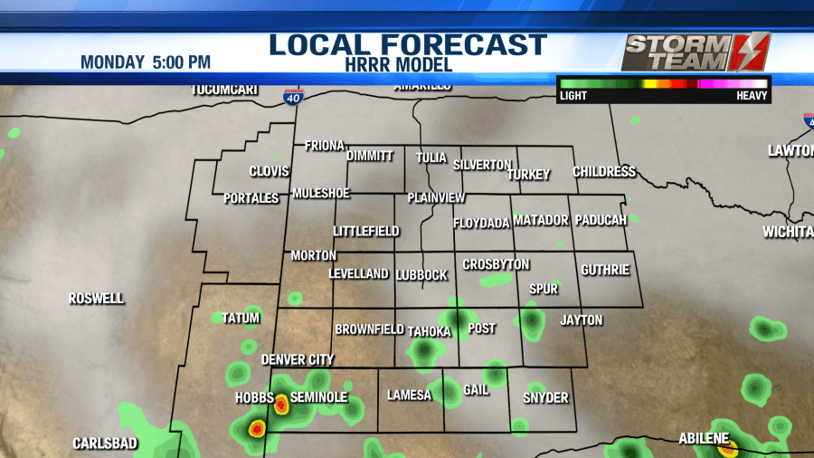
As we start off the month of June, temperatures will actually be a few degrees below average thanks to increased cloud coverage. We will top out in the lower to middle 80s on Monday under a partly to mostly cloudy sky. Areas to the south of Lubbock will see more cloud coverage than areas to the north of town. As we get into the afternoon hours, southeasterly winds around 15-20 MPH will bring in enough moisture to allow a few showers to develop mainly to the south of Lubbock. We can’t rule out a rumble of thunder or two, but thankfully no severe weather is expected. Shower activity will taper off after sunset. Low temperatures will drop into the middle and lower 60s by Tuesday morning.
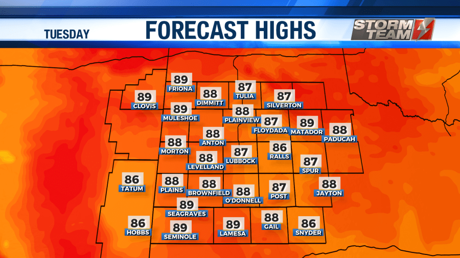
For Tuesday, we will remain mainly dry across the area. An isolated sprinkle or two cannot be ruled out during the afternoon hours. Highs will rebound into the upper 80s and lower 90s under a mostly sunny sky. Winds will remain gusty at times out of the southeast, occasionally approaching 30 MPH. If you plan on being outside this week, be sure to wear sunscreen! Burn time will only be about 10-15 minutes. Overnight, we will see a mostly clear sky with lows falling into the middle 60s.
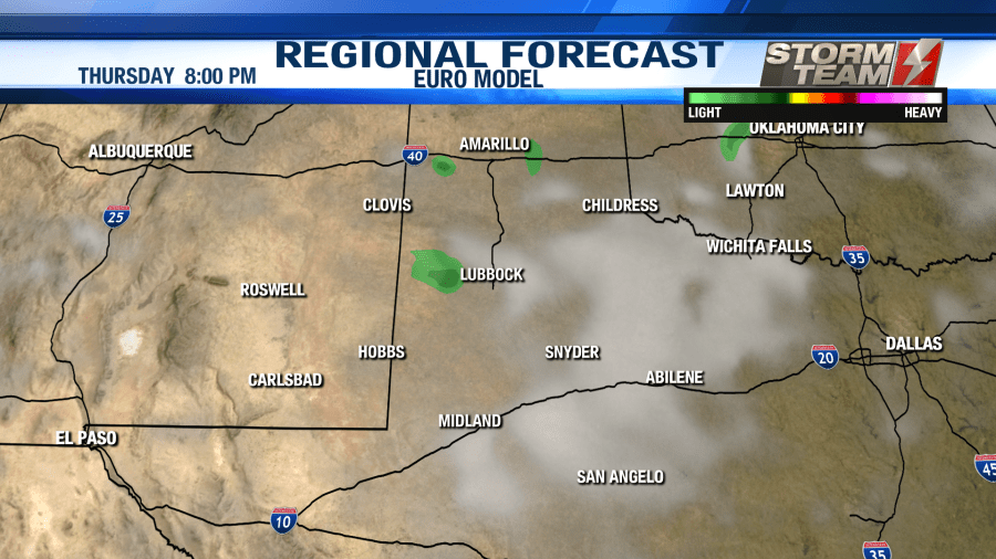
On Wednesday and Thursday, a break in the ridge will allow for a few afternoon showers and storms to develop. No significant rainfall is expected, but a few of us could see a few drops of rain. We will warm for Wednesday and Thursday, with high temperatures peaking in the middle 90s to lower 100s for some locations! We will keep a mostly sunny sky across the area both days, with winds up to 30 MPH out of the south-southeast at times. Low temperatures will remain in the middle to lower 60s.
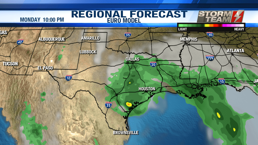
As we head into the weekend, highs will remain in the middle to upper 90s across the South Plains. Low temperatures will also remain in the middle 60s. Further south, along the Texas coast, we will have to keep a close eye on a potential tropical system. Models are suggesting that a tropical disturbance could move into coastal portions of Texas as soon as Saturday night next weekend. This could bring flooding rain to the region. It doesn’t look like we will pick up any moisture from that system here in West Texas.
Have a wonderful week!
-Jacob.
Facebook: Meteorologist Jacob Riley
Twitter: @jrileywx