
LUBBOCK, Texas — KAMC Meteorologist Ron Roberts has your Tuesday evening forecast. Sponsored by J Ferg Pros.
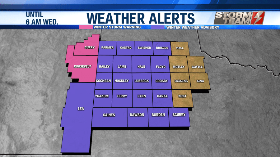
Another round of freezing rain, sleet and snow will move into the South Plains later this evening, lasting into the early morning hours of Wednesday. A Winter Weather Advisory remains in effect until 6 AM Wednesday morning.
A storm system located near the New Mexico/Arizona state line will move across the South Plains within the next 12 hours. Precipitation will move back into the region around 6-9 PM tonight.
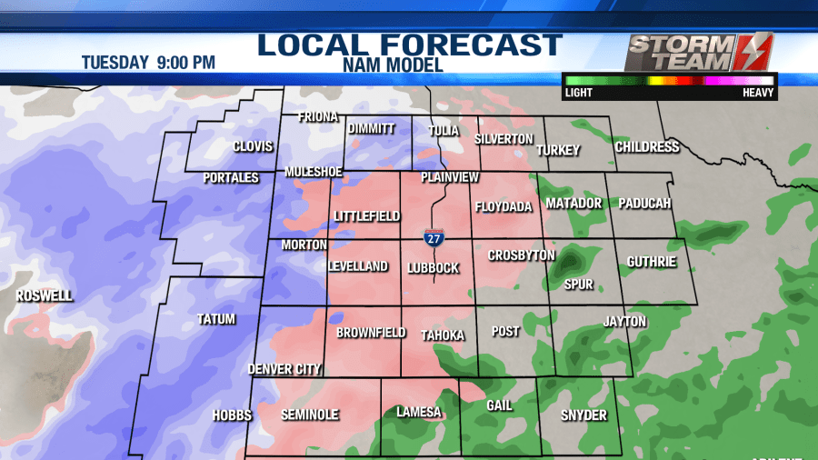
Precipitation will likely start off as sleet in the Lubbock metro area. Warm air aloft will melt the snow higher up in the atmosphere initially. As time goes on, the warm air aloft will fade away over Lubbock.
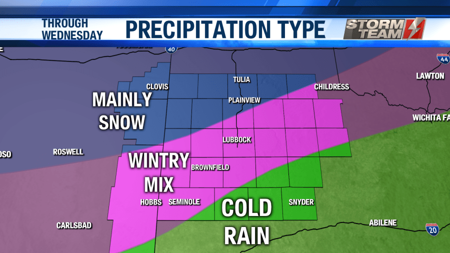
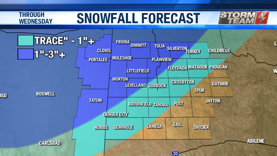
Areas to the northwest of a line from Lovington, NM to Silverton, TX will remain mostly snow, thus seeing the highest accumulation amounts. A few heavy bands are possible with this system. Wherever those set up, snowfall totals will be higher. The snowfall map below does not account for snow that fell earlier in the day on Tuesday.
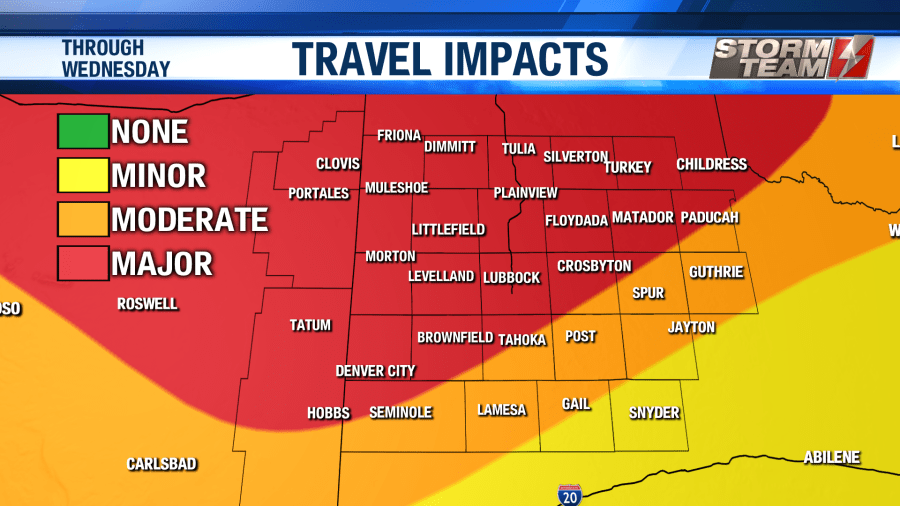
Precipitation will begin to exit the region around sunrise on Wednesday morning. After the precipitation comes to an end, clouds will start to decrease across the area. Travel will remain hazardous until noon on Wednesday for most of the area. High temperatures will warm into the lower 40s for the Lubbock-metro. Areas to the northwest, that see more snowfall, will remain in the middle to upper 30s. Snow will melt quite a bit across the region.
A few slick spots may redevelop Thursday morning as melting snow refreezes on area roadways. By Thursday afternoon, travel conditions will be back to normal for the South Plains. As we look forward to the weekend, high temperatures will warm back into the middle and upper 60s.
Have a warm and safe night!
-Ron
Facebook: Ron Roberts KAMC
Twitter: RonRoberts.TV


