
LUBBOCK, Texas — KAMC Meteorologist Jacob Riley has your Sunday evening forecast. Sponsored by J Ferg Pros.
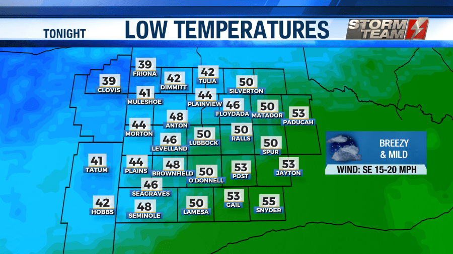
Tonight: Increasing clouds, low of 48°. Winds out of the SE, 15-25 MPH.
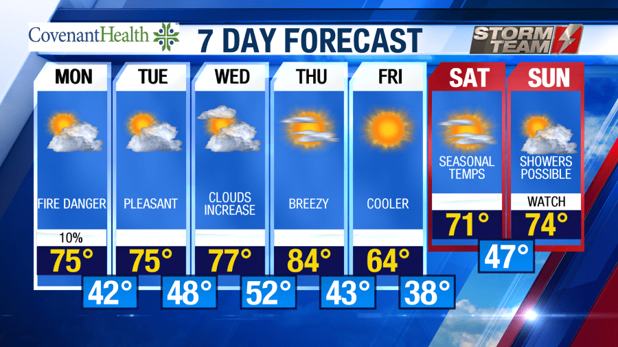
Tomorrow: Partly cloudy, high of 75°. Winds out of the WSW, 20-40 MPH
As we head into the evening and overnight hours on your Sunday, winds will begin to increase out of the southeast. Gusts could approach 30 MPH at times. Temperatures will remain mild, only falling into the upper 40s and lower 50s. Some patchy fog could be possible across the Permian Basin and Rolling Plains, but it will remain isolated in nature.
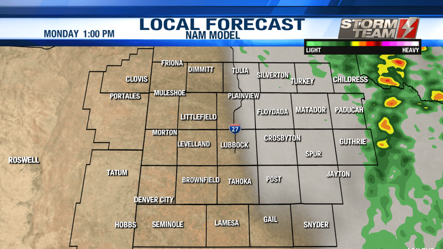
As we kick off your work-week, strong winds will return to the area. Winds will be sustained between 20-30 MPH out of the west-southwest, with gusts exceeding 40 MPH at times. Portions of the region are under a critical threat for fire weather. This is why the National Weather Service has issued Red Flag Warnings and Fire Weather Watches for portions of the South Plains.

High temperatures will warm into the middle 70s across the area under a partly cloudy sky. A few showers will be possible across extreme eastern portions of the area. No significant rainfall is expected. Winds will begin to subside overnight Monday into Tuesday morning as lows dip into the upper 30s and lower 40s.
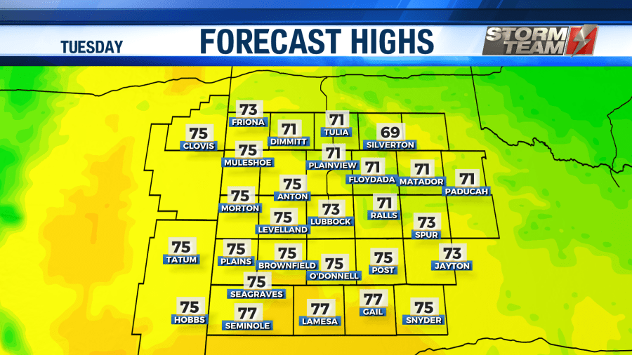
Tuesday will be a nice and pleasant day across western Texas and eastern New Mexico. We will see high temperatures in the middle 70s under a partly cloudy sky. Winds will remain calm and variable, occasionally gusting to 20 MPH. Overnight lows will be mild for this time of year, only falling into the upper 40s and lower 50s.
We will be slightly warmer across the region by Wednesday. More clouds will move into the area from the southwest, with winds close to 20 MPH. Clouds will slowly fade overnight, keeping temperatures in the lower 50s.
For the remainder of the work week, more sunshine will return to the area with highs slowly warming into the lower 80s by Thursday evening. Thursday night, a cold front will swing through the area, resulting in highs in the middle 60s on Friday. Overnight lows will fall into the upper 30s and lower 40s Thursday and Friday night.
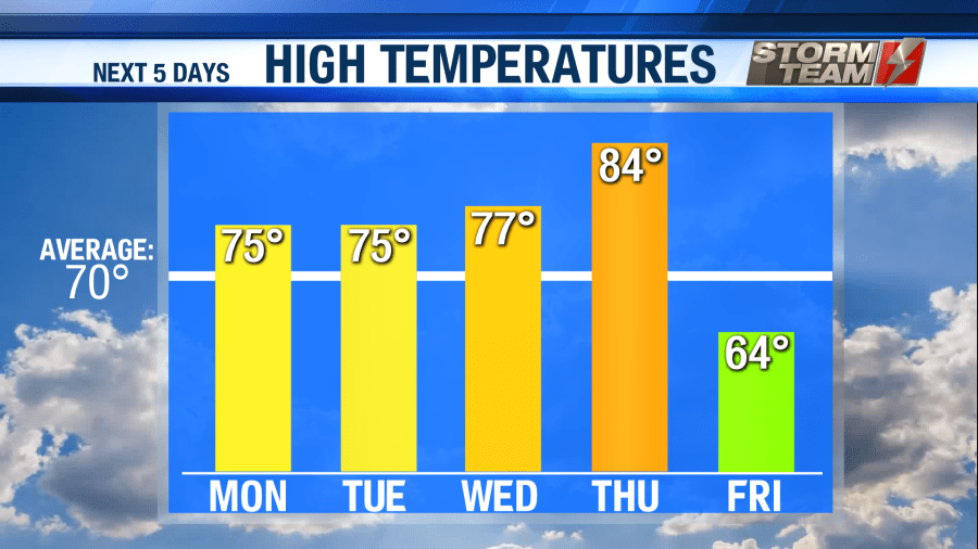
Next weekend, temperatures will rebound to average levels, topping out in the lower to middle 70s for daytime highs. Overnight lows will remain above average, only falling into the upper 40s and lower 50s. By Sunday, we could see a few showers across portions of the area. Our two main global models are suggesting that we could see a few showers or storms later in the day on Sunday. Right now, we will call for isolated showers next Sunday, with no severe weather expected.
Have a safe and wonderful week! Remember; a Stay At Home order goes into effect at Midnight tonight (03/29/2020), and lasts through Friday, April 3rd.
-Jacob
Facebook: Meteorologist Jacob Riley
Twitter: @jrileywx
This post was updated at 10:32 PM CDT to add the forecast video.


