
LUBBOCK, Texas — KAMC Meteorologist Jacob Riley has your Sunday evening forecast. Sponsored by J Ferg Pros.
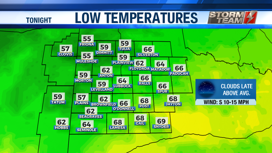
Tonight: Clear, low of 63°. Winds from the S 10-20 MPH.
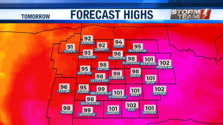
Tomorrow: Mostly sunny, high of 98°. Winds out of the W, 20-30 MPH.
Overnight tonight, lows will remain above average. We will keep a mostly clear sky around tonight, with lows falling into the upper 50s to middle 60s. As we get closer to sunrise, a few more clouds will begin to move into the area. Winds will be out of the south around 10-15 MPH.
Well-above average temperatures will return for Monday. Highs will warm into the upper 90s and lower 100s across the entire South Plains region. Westerly winds, also known as downsloping winds, will really help temperatures warm.
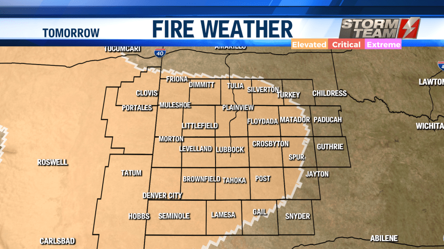
Wind gusts will exceed 35 MPH at times. These breezy and dry conditions have prompted an elevated risk for fire weather, especially over western portions of the area. Outdoor burning is NOT advised.
Overnight, a cold front will move into the area. Winds will shift to the northeast, gusting close to 35 MPH at times. Lows will range from the middle 40s to the lower 60s under a partly to mostly clear sky.
The first round of cooler air will be felt on Tuesday. Highs will fall into the middle 70s and lower 80s under a mostly sunny sky. Winds will remain around 20-25 MPH out of the northeast. Gusts could exceed 35 MPH at times. Overnight, lows will remain cool, falling into the middle 40s and lower 50s.
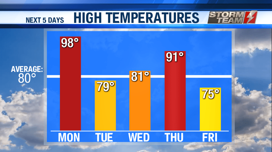
By Wednesday, winds will start to take on more of a southerly component. Winds will be out of the southeast around 15-20 MPH. This will allow temperatures to warm back into the middle and upper 80s. A few afternoon showers will be possible, especially across southeastern portions of the region. Unfortunately, no significant rainfall accumulation is expected. Overnight, lows will be a bit warmer, only falling into the upper 50s and lower 60s.
Temperatures will be a bit warmer by Thursday, topping out in the upper 80s to middle 90s. A few isolated showers will remain possible during the afternoon and evening hours. Winds will be gusty out of the southwest, exceeding 30 MPH at times. Fire weather will be possible once again. Overnight lows will be in the upper 50s and lower 60s.
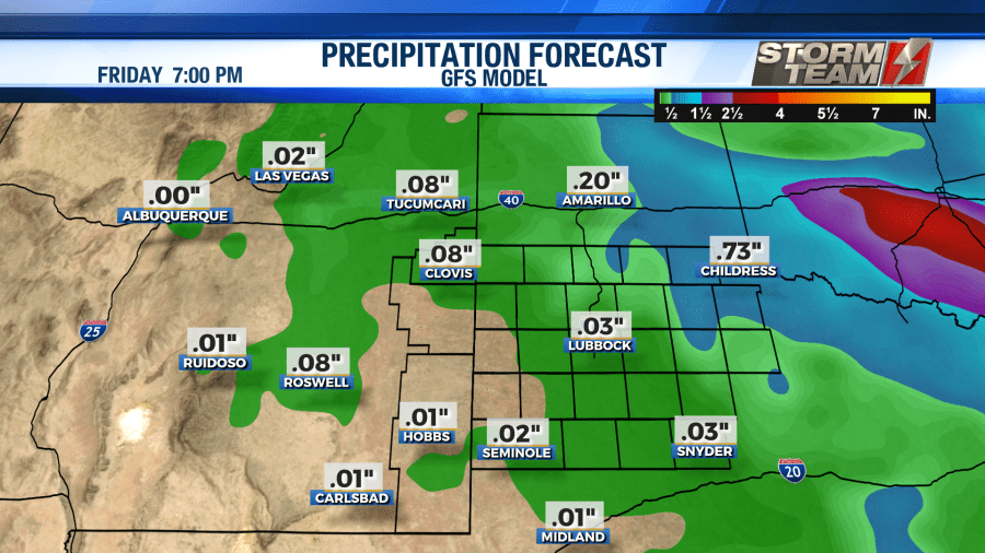
Temperatures will cool down as we head into the weekend! Highs will fall into the middle and lower 70s Friday through Sunday. It looks like we will remain dry. Overnight lows will be cooler, ranging from the middle 40s to the lower 50s.
Have a wonderful week! Stay safe, friends.
-Jacob.
Facebook: Meteorologist Jacob Riley
Twitter: @jrileywx
This post was updated at 11:04 PM CDT to add the forecast video.


