LUBBOCK, Texas — KAMC Meteorologist Jacob Riley has your Sunday evening forecast. Sponsored by J Ferg Pros.
Overnight tonight, temperatures will remain well above average. Lows will fall into the upper 30s and lower 40s under a partly cloudy sky. Winds will remain breezy, gusting close to 30 MPH at times.
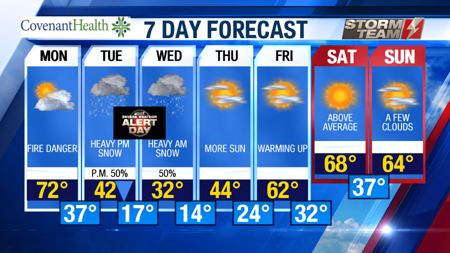
Enjoy the warmth on Monday because a HUGE change will arrive on Tuesday. High temperatures on Monday will be 15-20 degrees above average, topping out in the lower to middle 70s. Winds will be breezy once again on Monday, gusting close to 40 MPH out of the southwest. These gusty winds will result in another day of an elevated risk of fire danger.
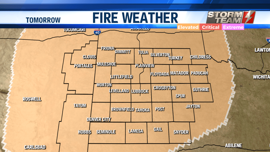
Outdoor burning is not advised. As we head into the evening hours, a cold front will begin to move into the region from the north. Thus will result in Tuesday’s high temperatures occurring at midnight. Lows will fall into the middle and upper 30s.
Tuesday will be a cold and windy day. A cold front will push all of the way through the region by 6 AM. This will result in northerly winds gusting close to 40 MPH at times. Arctic air will filter into the area, with most locations hovering close to freezing by noon on Tuesday. Wind chill values will be in the single digits by 3 PM. Around 6 PM, snow showers will begin to develop along the Texas-New Mexico state line.
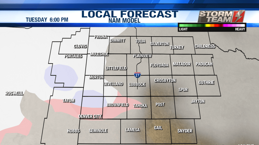
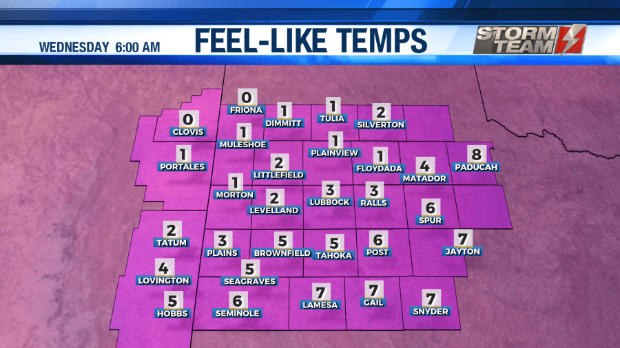
This activity will continue to increase and spread to the east across the South Plains. Snow will begin to accumulate as soon as it falls. We may see a brief period of sleet mixed in with the snow, but most of the precipitation should fall as snow. Heavy snow will continue to fall for the remainder of Tuesday evening into the overnight hours. This will result in reduced visibility and treacherous driving conditions across the entire region. DO NOT get out on the roads unless you absolutely have to. Wind chill values will fall close to 0. Even some negative wind chill values will be possible across northern portions of the South Plains by Wednesday morning.
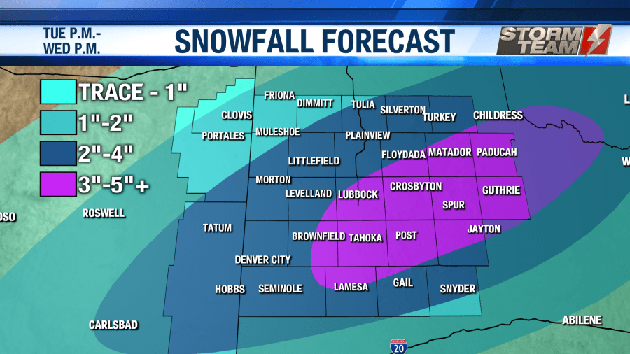
Heavy snow will continue throughout the morning hours on Wednesday. Actual air temperatures will be in the middle 10s across the South Plains. Driving conditions will remain hazardous throughout the entire day on Wednesday. By 5 PM Wednesday evening, most areas should see the snow come to an end. Snowfall totals will generally be between 2-4 inches, but some areas could see as high as 8 inches before all is said and done with.
Breezy conditions will result in a reduced visibility, keeping hazardous travel conditions across the area through Thursday morning. Ice will likely occur on area streets, in addition to bridges and overpasses. Be sure to slow down, turn off your cruise control, and leave extra space for you and the vehicle in front of you if you just absolutely have to be out on area roadways. Overnight lows will fall into the middle and lower 10s once again Wednesday night. Wind chill values will be in the lower single-digits.
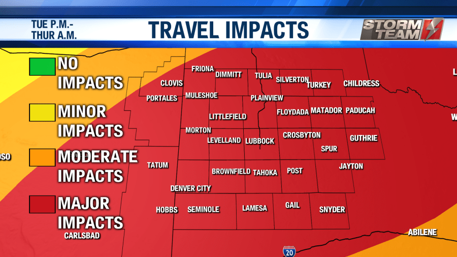
Thursday will be another cold day. Sunshine will return to the region, helping to melt some of the snow across the area. High temperatures will warm into the lower and middle 40s across the region. Snow will still be on the ground overnight Thursday into Friday morning. Lows will fall into the lower 20s and upper 10s.
Most roadways should be driveable by Friday morning. A few slick spots can’t be ruled out on bridges and overpasses. Most of the snow that is left will melt away on Friday. High temperatures will warm into the upper 50s and lower 60s with winds out of the southwest around 8-12 MPH. Sunshine will aid in melting the remainder of the snow. Overnight lows will be cold, falling into the upper 20s and lower 30s.
Next weekend will be nice and warm with high temperatures in the middle to upper 60s. What they say about west Texas is true. If you don’t like the weather, just stick around for a few days. It will most definitely change.
Please stay tuned to KAMC News through TV, social media and everythinglubbock.com over the next few days. We will continue to provide you the latest information on the potential of this week’s winter storm.
Have a warm and safe week friends!
Have a super Sunday!
-Jacob
Facebook: Meteorologist Jacob Riley
Twitter: @jrileywx
This video was updated at 10:30 PM to add the forecast video.


