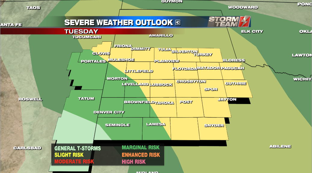
**UPDATE 11:45 AM** Upgrade to a SLIGHT risk of severe weather for the north and eastern South Plains.
KAMC’s Storm Team Meteorologist Alex O’Brien has the forecast for 5.15.18.
TODAY: SEVERE WEATHER ALERT DAY. There is a 30% chance of thunderstorms this afternoon as a dryline and stationary front provide lift for storm development. Again, the north and east South Plains has the greatest storm chance today. Lubbock county will be hit or miss. A few of these storms may reach severe strength with hail at least 1 inch in diameter and wind gusts over 58 mph. Timing will be from 4 – 8 pm and we expect to clear out by the time the sun goes down. The forecast high for Lubbock today is 92 degrees, which is above the average high of 84 degrees.
TOMORROW: There is still a marginal risk of severe weather on Wednesday, with a few severe storms possible. The dryline will likely set up in the central and east South Plains again. But, storm coverage will be sparse at a 20% chance. Most of the region will see a sunny day with temperatures reaching the upper 80s and low 90s. The forecast high for Lubbock tomorrow is 91 degrees.
Send me your weather photos!
-Alex
Facebook: Meteorologist Alex O’Brien
Twitter: @WXAlexOBrien
Email: aobrien@kamc.tv


