LUBBOCK, Texas — KAMC Meteorologist Jacob Riley has the details on today’s severe weather potential. Sponsored by J Ferg Pros.
Most of the South Plains is under the gun for severe weather once again this afternoon. Storms are expected to develop between 3-5 PM along the Texas-New Mexico state line.
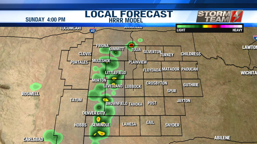
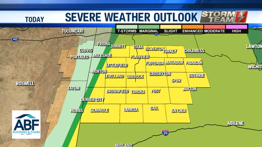
The areas in the highlighted yellow area below are under a Level 2 Slight Risk for severe storms. Locations in the dark green region are under a Level 1 Marginal Risk for severe storms.
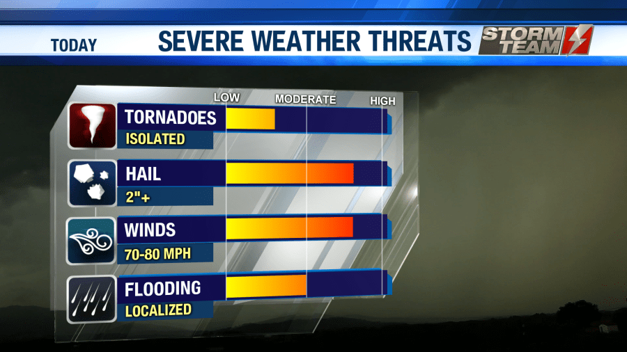
Our main concerns with today’s severe weather threat will be damaging winds over 60 MPH, large hail around the size of baseballs (3.00″), localized flooding and isolated tornadoes. Below are each risk categories, showing which locations have the greatest potential to see that particular type of severe weather. We do have a hatched region for hail, which means significant hail sizes (over 2.00″) are expected.
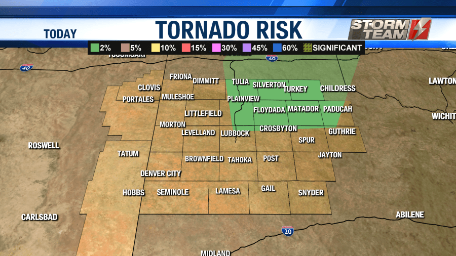
Today’s tornado risk. 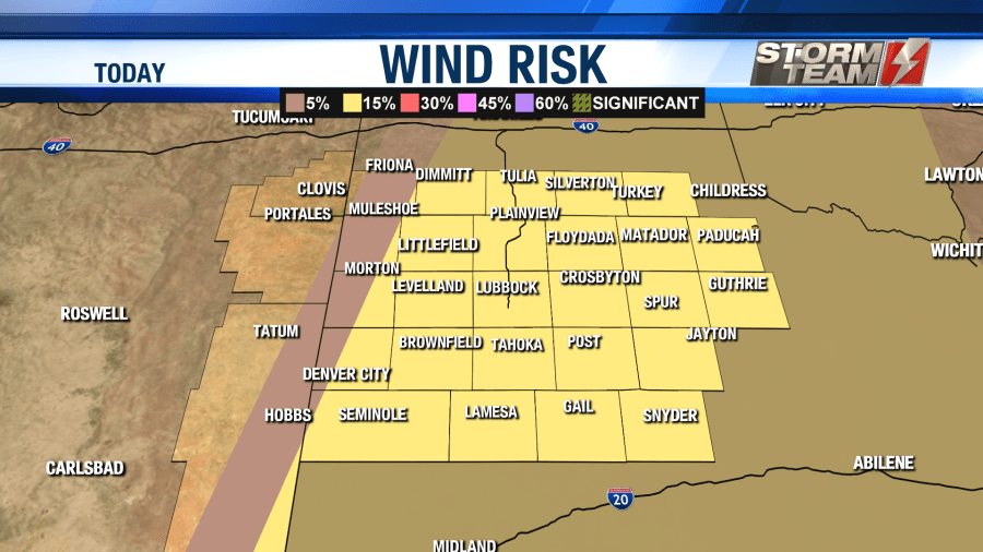
Today’s wind risk. 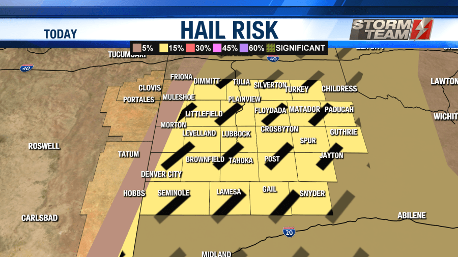
Today’s hail risk.
As we progress through the evening hours, storms will become more linear. When this happens, we will likely begin to see stronger winds out of these storms. Once the sun sets this evening, storms will begin to lose their strength. All severe weather activity will come to an end by midnight tonight.
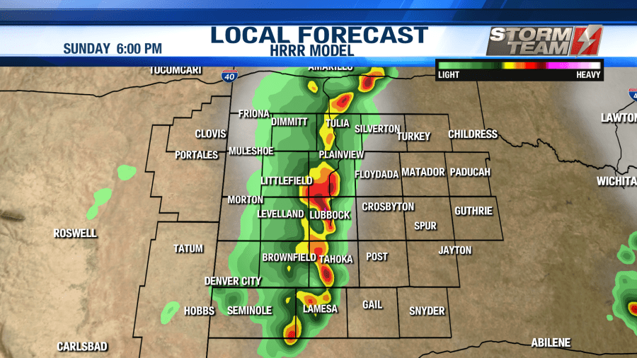
Future Radar at 6 PM this evening. 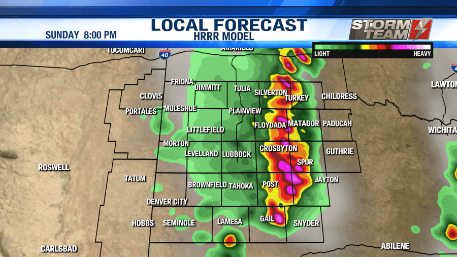
Future Radar at 8 PM this evening. 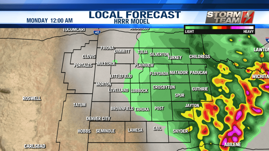
Future Radar at midnight tonight.
So as a recap, severe storms are expected once again today, Sunday, May 24th, 2020. Damaging wind gusts over 60 MPH, large hail close to the size of a baseball (3.00″), localized flooding and isolated tornadoes will all be possible. Our main concern will remain focused on the potential for large hail and damaging winds.
Timing for this event will be from 3 PM until 12 AM. Be sure that you and your family remain weather aware this afternoon! Today will not be a great day to venture out to area lakes.
Have a safe and happy Memorial Day on Monday!
-Meteorologist Jacob Riley
Facebook: Meteorologist Jacob Riley
Twitter: @jrileywx


